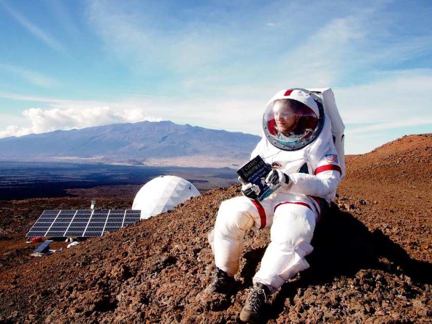
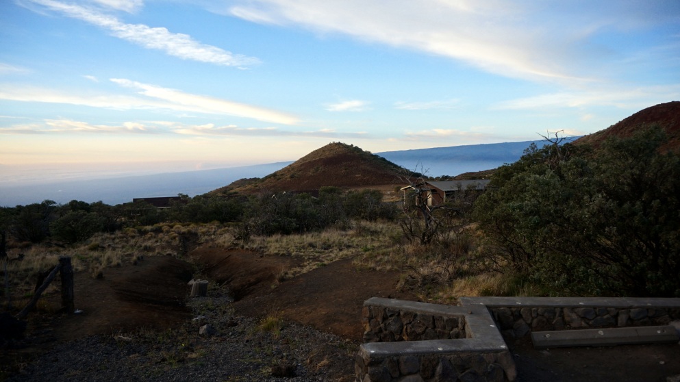
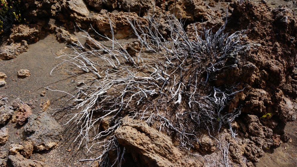
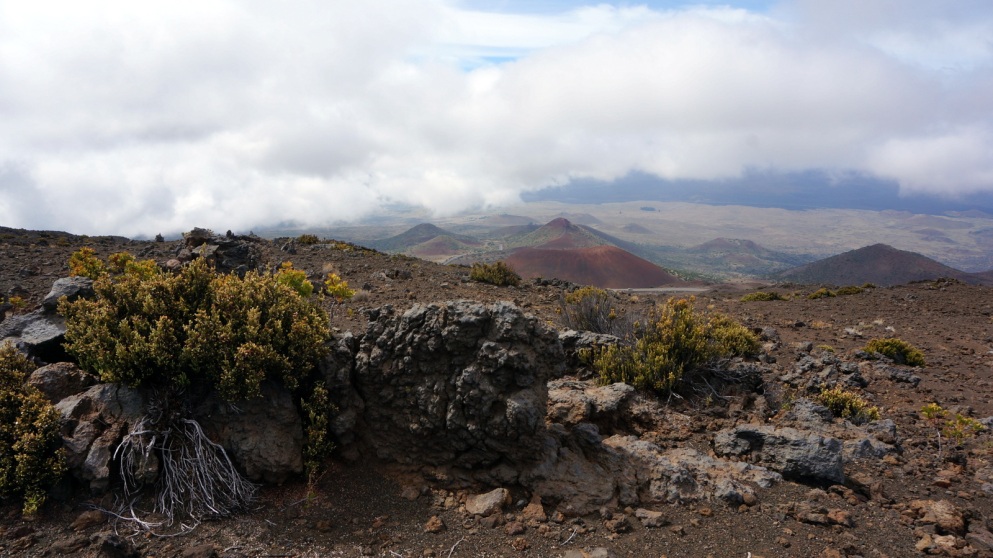
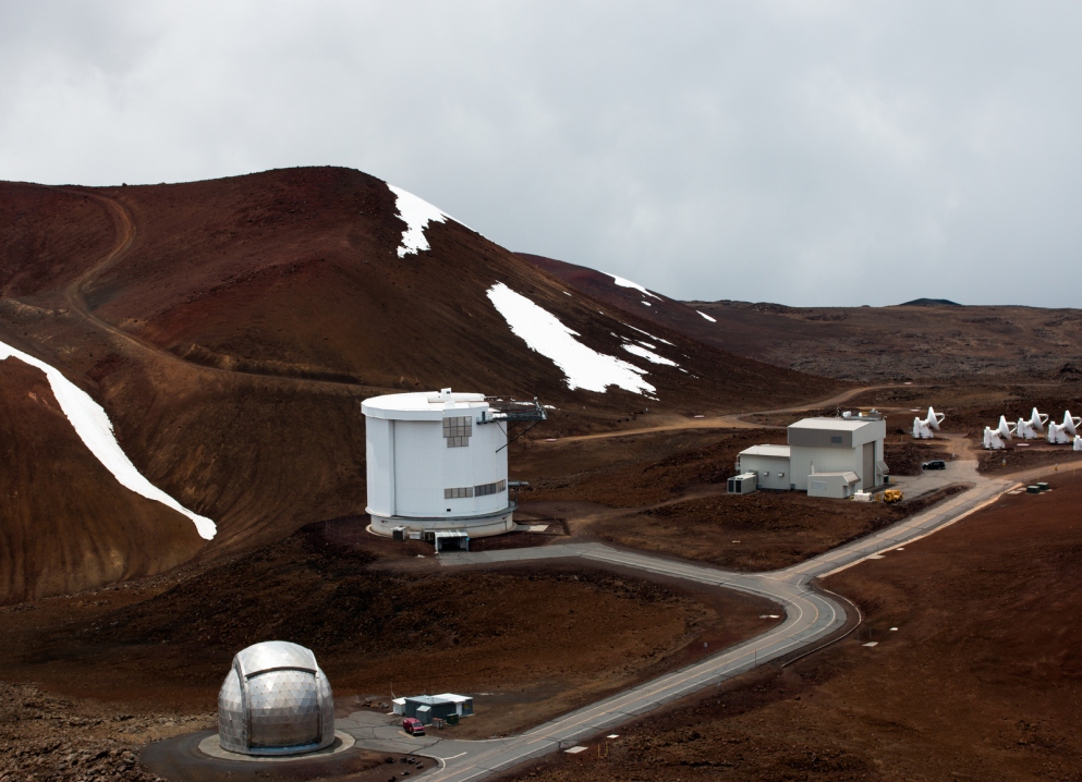
This photograph, which looks either photoshopped or straight out of a Hollywood production, is in fact neither and was taken outside the Hawai’i Space Exploration Analog and Simulation (HI-SEAS) Habitat situated on Mauna Loa (“Long Mountain”) on the Island of Hawai’i (also known as the Big Island). This location’s Mars-like geology was selected to emulate long duration (extraterrestrial) missions. “The Martian regolith […] is very similar to the weathered basaltic materials found in this part of Hawaii.” In the background of this photograph, the summit of the dormant volcano Mauna Kea (“White Mountain”) is visible.
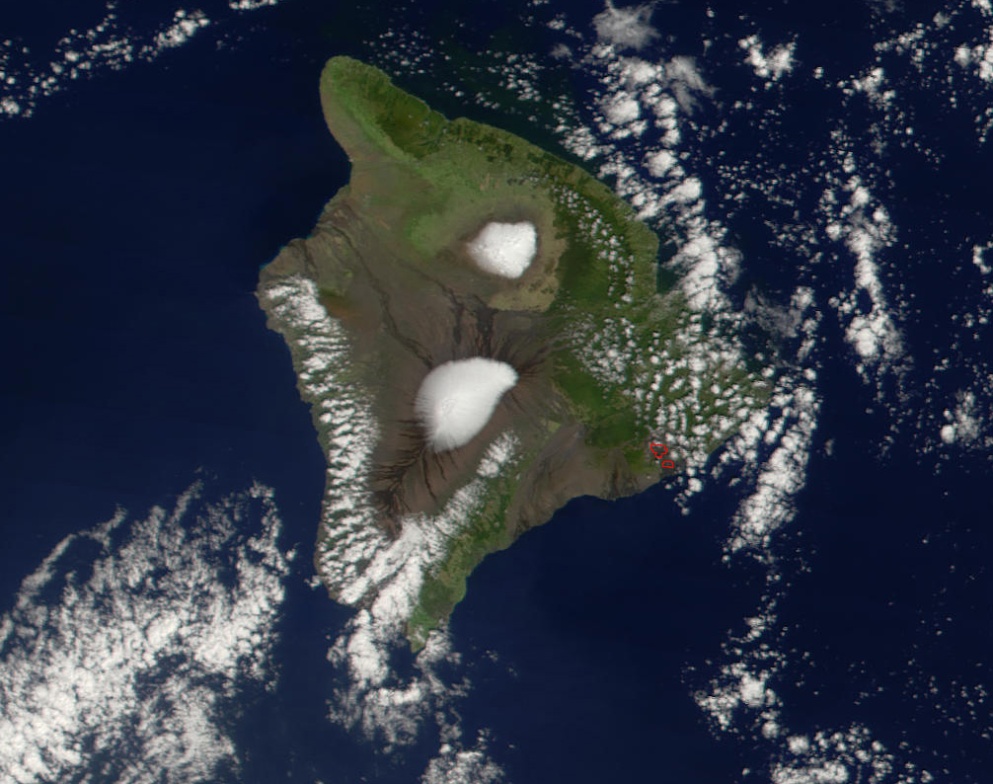
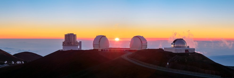
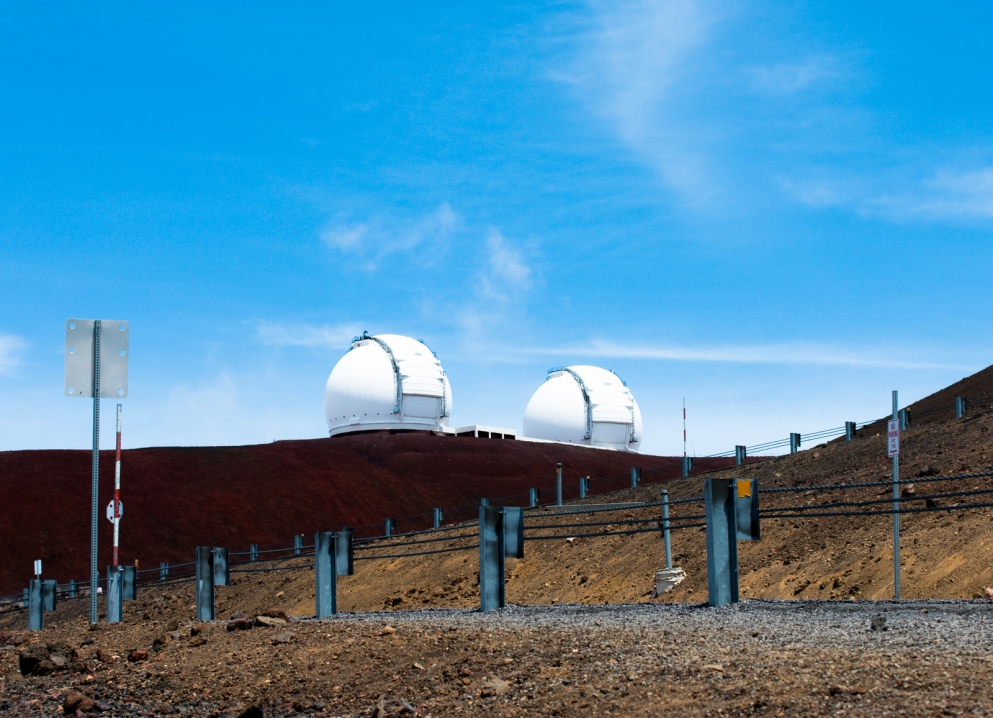
Mauna Kea and Mauna Loa are quite the eye-catchers even from afar in outer space. While Mauna Loa is the location of HI-SEAS, an abundance of scientific activity is happening on the summit of Mauna Kea, too. Situated at an altitude of 4,205 meters (13,796 ft) above sea level, the Mauna Kea summit is at above 40 percent of the Earth’s atmosphere. Furthermore, the air is extremely dry, the atmospheric condition exceptionally stable, and the light pollution scarce, establishing excellent conditions for astronomical stargazing. To quote the Institute of Astronomy, “there are currently thirteen working telescopes near the summit of Mauna Kea. Nine of them are for optical and infrared astronomy, three of them are for submillimeter wavelength astronomy and one is for radio astronomy.”.
According to geology.com and the Institute of Astronomy of the University of Hawaii, the summit of Mauna Kea rises 9,750 m (32,000 ft) above sea floor, which makes it not only the tallest volcano but also the tallest mountain on earth! (Mount Everest is the mountain at the highest altitude above sea level.)
The summit, sacred to the Native Hawaiins, also holds its own significance in the eyes of the scientists. It is a gateway to the past and the future to both groups of people. And for us, a group mainly consisting of physics and engineering students, it just made sense to venture on a hike that led to the eye and the ear of the Earth into the everything and nothing out there.
Our group of seven consisted of six moderately to highly athletic people with varying degree of athletic ambition and motivation… and me. Gym class was my worst subject at school. I have always been slower, clumsier and less durable than my peer. We were presented with three options on how to manage the distance between the Visitor Center at 2,800 m (9,200 ft) accessible by car and the summit at 4,205 meters (13,796 ft) above sea level:
- Option 1: Rent a four wheel drive (only allowed type of vehicle from the Visitor Center upwards due to high requirement on brakes). (We had already rented a car that did not satisfy that criterion.)
- Option 2: Book a > 150 $ tour. (We are PhD students, so youth is all we got, and money is not.)
- Option 3: Hiking. (We are PhD students, so youth is all we got, and youth presumably comes with strong legs and tight butt cheeks.)
According to the official website, the hike takes 8 hours roundtrip for experienced hikers. From the Visitor Center to the summit a distance of 10 km (6 miles) has to be covered, while gaining an elevation of 1,400 m (4,600 ft). The average slope is, I calculated, 14%.
Initially I was sceptical whether this kind of quest was anything I would challenge myself with. The trail was rated with the highest degree of difficulty by all consulted sources. An altitude gain of 1400 m was double the amount of what I climb on Sunday afternoons in the hills near my town. Additionally, the thin atmosphere was not a hiking condition that I was experienced with. Before the trip, my friends and I talked over our doubts and agreed on only venturing the climb if weather and health condition were met. Also, in case of altitude sickness, a person would not be left to set out alone, whether downhill or eastward to the road.
After days of weather monitoring by the hour we decided that weather condition was above average optimal and stuck to our ascent plan. Sunny weather was predicted to dominate until noon. From that point on, clouds would amass quickly and bring snow to the summit and both hail and rain to the land at lower altitudes. This meant that in order to not be caught in bad weather, which would further increase the complications of the hike, we absolutely had to get to the summit swiftly in 5,5 hours of time. It was either being fast enough to manage the hike within the safe time range or abandoning it midway to avoid possibly running into the danger arisen from a combination of bad weather and (in that case probably even more so) less than ideal physical condition.
We considered this plan to be reasonable since it roughly matched the suggested average roundtrip time of 8 hours. For descents are usually less time-consuming, we would still have time to take a break at the summit, tour the only telescope that is open to public, and then be back at the Visitor Center a few hours before sunset.

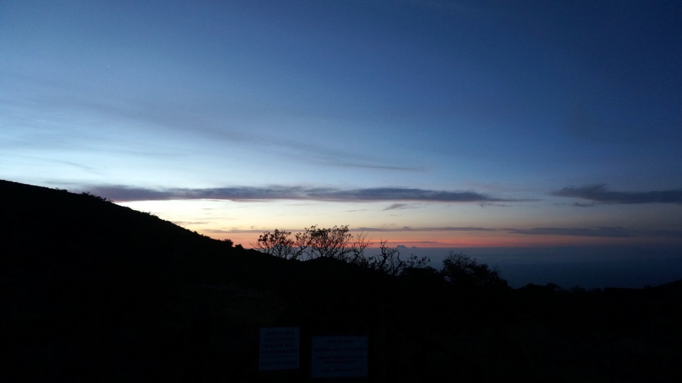
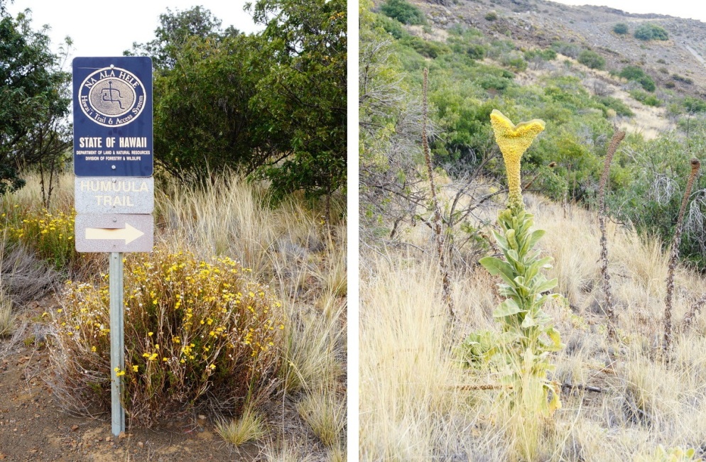
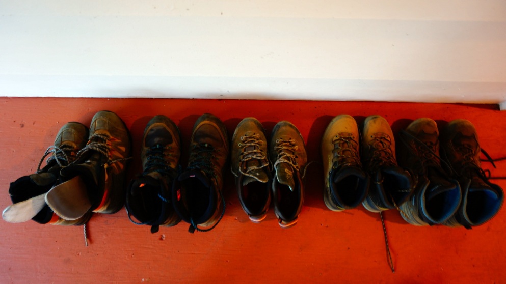
We got up at 3 am, left the accommodation at 4 am and arrived at the Visitor Center at 5:30 am. The high altitude combined with the fact that the sun has not yet risen meant that we had breakfast in freezing winds while being covered in layers and layers of insolating outdoor gear from head to toe. We took our time acclimatising and set off at 6:30 am. Each of us wore hiking shoes, long pants, long sleeves and light jackets. We had fully charged phones equipped with GPS, an elevation map, at least 4 litres of water each, snacks, and aspirin for headache. After breakfast, we registered at the letter box of the Visitor Center so that people would look for us in case we were stuck on the trail for some reason.
We split into two groups. The faster group had higher athletic ambitions and on average superior physical conditions. The slower group took the ascent with a more laid-back attitude and set the goal to climb as high as one can without overexerting oneself. I felt more tired than I should have at the very first step of the ascent. This was probably attributed the three factors. One, I had arrived in Hawai’i only four days earlier, and even though I did not feel jetlagged, the 24 hours of travel had probably been a toll on the body. Two, the previous two days had been weaved with hiking and (short) biking tours (the latter of which I had not done since the sixth grade) which led to some pre-programmed muscle tiredness. Three, I had slept 4 horus the night before, certainly not a whole lot to be bursting with energy.
Soon after we had started the ascent the Hawaiin sun was blasting with such power that in combination with the physical efforts, clothes started to get soaked by perspiration. The air was chilly nevertheless, so that staying put resulted in the body to quickly cool down. Sunscreen was replenished and generously smeared on the face, the neck, the ears and the back of the hands. The cool wind was a wilfully deceptive magician that tricks you into thinking that you cannot get sunburned if your skin does not feel hot.
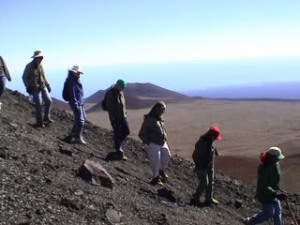
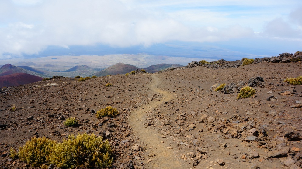
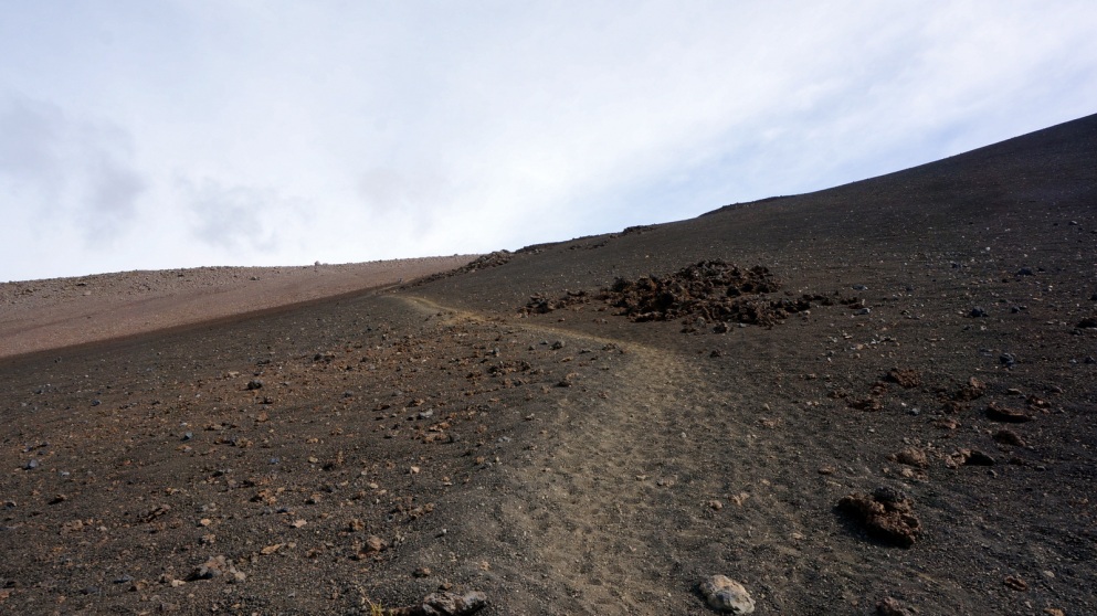
The soil beneath our feet consisted mostly of fine, loose rocks. One step up meant sliding half a step down. At times the sandy texture of the trail was so fine that it felt like climbing up a cruel sandbox for masochistic adults. Hiking uphill on sand made an elevation gain, which elsewise would not have posed any problem, an extremely strenous task. Standing still so that muscles could catch a short break was no use since it was so steep that the muscles were tightened regardless. Benches were, of course, not provided by mother nature, and the few rocks that were of the appropriate size to serve as seats were either far off the track or often of such unforgivingly spiky nature that one resorted to doing a quick, involuntary squat when trying to rest on one of them.
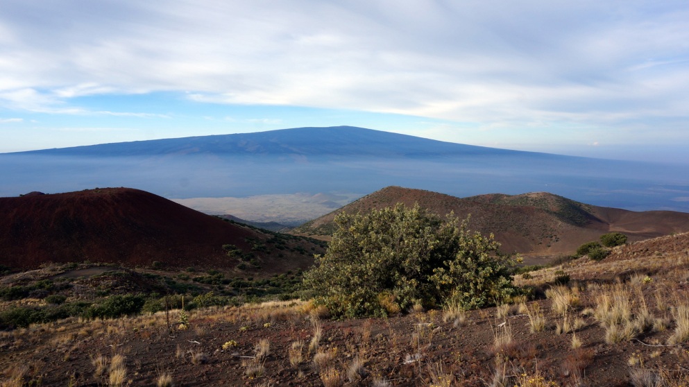
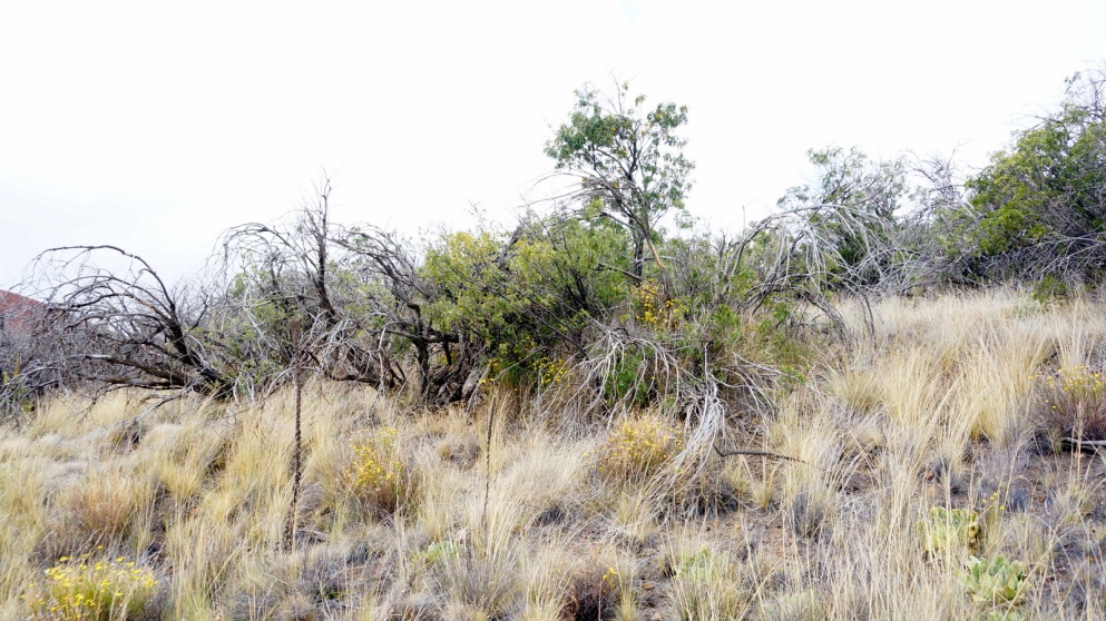
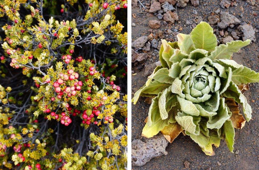
After roughly an hour Mauna Loa started to accompany us. We had a clear view on its summit during the early hours of the morning. The view to our back was spectacular. The lower section of Mauna Loa was enclosed by a veil of mist and water vapour. Several cone-shaped hills between Mauna Loa and Mauna Kea were of manifold intense discolourations. Even in a landscape as desolete as this volcano life still found its way to thrive. As we climbed uphill, the vegetation changed rapidly. Trees were substituted by bushes, scrubs and weeds.
The initial two hours of climb was largely demanding due to the steepness and the loose texture of the soil. Both factors made the elevation gain feel much more strenous than it would have been in the case of solid ground. The weight of the water bottles on the back and the more restrictive long clothes (in comparison to shorts and t shirts) did not make things easier.
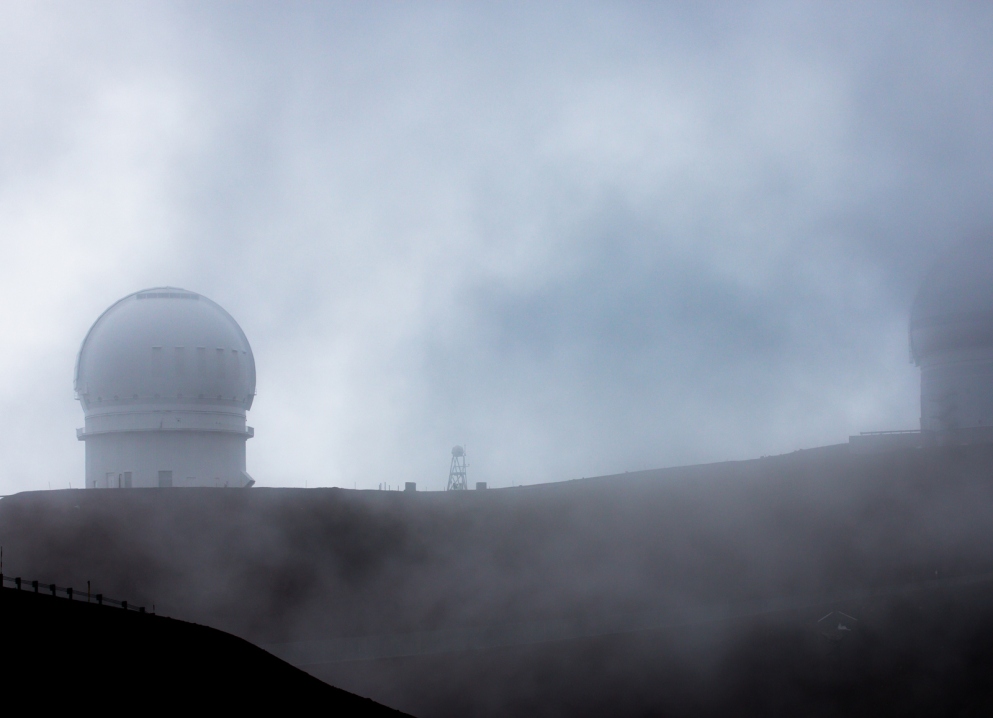
Often, one could not see past the small hill on which one was walking. After having finally reached the top of one hill only meant stepping onto another hill, which stretched in front to an seemingly unattainable point, hidden from sight. Muscles became permanently fatigued and were in desperate need for a proper break. Some muscles in the hip area were complaining insistantly, for the fact that they had never been used this intensely before. My two companions both had more stamina and they waited for me a lot more frequently than I would have found comfortable. Clouds quielty enclosed the volcano around us, which reminded us that time and weather were running a race against us.
After roughly a third of the elevation gain and three hours of time since the start, I estimated that I only had enough energy to climb another third of the trail. After that, effects of the thin atmosphere would presumably really start to kick in, making the last third practically impossible to bring about. Additionally, reaching the top was not even the end of the hike. One needed to have enough stamina to climb all the way down while being fully concentrated so as not to slip and fall. The steepness did not facilitate a relaxing descent either. Leg muscles, though of another group, had to constantly be on braking mode so that one would not roll down the volcano like tumbleweeds. With my current speed, I would reach the summit by 3pm, earliest, which leaves me little time to climb down, and you definitely would not want to be stuck on a volcano in darkness that was fairly similar to its adjacent friend Mauna Loa, which served as a training ground emulating Martian environment for good reasons.
Even if I reached the summit earlier than that, I would not be in good shape, and nobody should be burdened with carrying me in case I twisted an ankle or felt abysmal 500 m before the finishing line due to altitude sickness. Furthermore, the other two would be faster without me, and judging by the current time and elevation gain, they still had a reasonable chance to reach the summit early enough to dodge the worst of the weather conditions during ascent.
After two rounds of discussion, I persuaded my companions to keep on climbing without me. It took quite a bit of effort, since they felt that it was irresponsible to let me go downhill by myself. Up until that point, we had not encountered a single other hiker on the entire trail, so if I accidentally hurt myself, I would be alone to get myself out of a dire situation. They reluctantly agreed to it as I was feeling well and otherwise fit enough to hike down on my own. I promised to text them every hour to report on my whereabouts.
After a longer break, I started the descent at a cautious pace and took time to have a closer look at the surrounding, which I had had no energy to focus on earlier. At the relatively leisurely speed, it took me 2 1/2 hours to return to the Visitor Center. It would still probably had taken me 2 hours even if I skipped taking photos. More often than not, I would unintentionally slide in the sand due to the steepness. It needs not always be wet for it to be slippery!
Hiking down alone was an eerie experience. There was no-freaking-body in my vicinity. I could see far and wide from where I stood and I was completely exposed to the sun light without any vegetation to hide me from sight, yet not a single person could see me. I could squat down to do a number two for half and hour right in the middle of the trail without any fear of being spotted by passerbys (still not recommended though for obvious reasons).
I could not help but feeling small and insignificant despite (or exactly because of) standing above the clouds and on top of a volcano that had created itself out of nothing starting one million years ago. It was one of the exceedingly rare occasions for a human in the mordern world to find themself physically isolated from other people. The sound of the shoes sinking into the sliding sands was the only thing that kept me company, while the clouds silently reached their arms to embrace this extraordinary landscape of closely intertwined patches of dark grey, ochre yellow and burgundy red basalt.
Finally, half way down at around 11am, I met two hikers with whom I had a little chat. One of them asked me if I was just coming down from the summit, to which I almost replied “Ha ha, good one.”
When I arrived at the car, the clouds have fully engulfed the volcanoes on either side. Aside from ours, there was only one car at the parking lot, which, I assumed, belonged to the other two women I ran into. Only a total of 9 people ventured on this hike that day (can hardly see why).
I slid onto the backseat and slept like a baby, until one girl from the faster group knocked on the car window at 1 pm. We went to the Visitor Center to have coffee and cup noodles and later met the rest of us. The fast group reached the summit after 6 hours of climbing. To set things in perspective: two of the people from the fast group were training to run a half-marathon in June, one girl had been learning Kungfu for nine years and rode a bike up the volcano Haleakalā on Maui three days later (don’t even get me started on that), and one girl was a former track and field athlete. Even these four, who are among the most athletic people in the category “non-professional hikers”, took 6 hours to get up there. The suggested 8 hours falls on the surprisingly speedy end of the total hiking time spectrum for the roundtrip. Taking necessary toilet and food breaks into account, you would need 10 hours in total if you had superb fitness. And 10 hours are much closer to the daily sunlight hours of 12 hours, leaving even less room for complications.
A few hundred meters before reaching the summit, where other visitors who drove up there could be found, the girl who later woke me in the car became overwhelmed by dizziness and nausea due to altitude sickness. At the summit, she found strangers who quickly drove her down by car. The road was very steep and curvy and the car tires smelt baldy due to overheating during the braking process. This did not make things easier when you are trying not to throw up.
The two friends who started the hike with me were close enough to the summit to see the observatories from afar when they saw the three others from the fast group coming downhill. They decided that they had gone up far enough, so the six of them hitchhiked down as well. Even though they all came down by car, one should not count on that possibility; therefore one should always ensure having enough energy to manage the hike down oneself in any case.
I am still quite proud of myself for trying despite not having reached the summit. Going uphill for 6 hours straight was exhausting for the others as well. I gave my best shot. It was better to be reasonable and safe than sorry. Overall, it was a worthy experience on a hike unlike any other and as close to the Moon or the Mars as you can get.
I visited Hawai’i in 2017. For other parts on Hawai’i click here.